December 21-23, 2004
|
|||||||||||||||||||
| Return Home | |||||||||||||||||||
| Return to Analysis Page | |||||||||||||||||||
| Historic Winter Storm Event | |||||||||||||||||||
|
|
|||||||||||||||||||
|
|||||||||||||||||||
| Chase Target: Paducah, Kentucky Driving Time: 0 Hours Storm Rating |
|||||||||||||||||||
| Chase Forecast: | |||||||||||||||||||
|
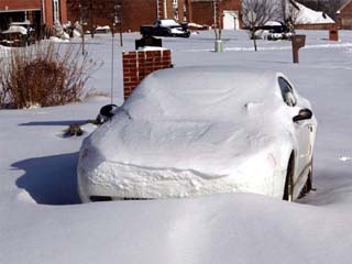
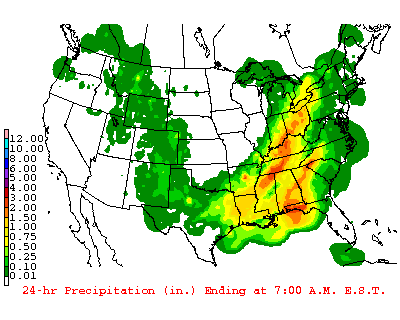
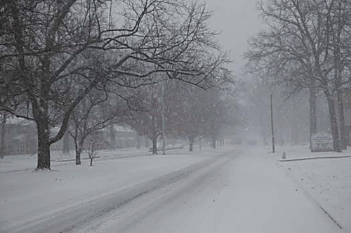
This was an easy storm for me to track and photograph. It was right in my backyard! This was a long duration weather event spanning over three days. December 21st through the 23rd. During that time copious amounts of precipitation fell across the Ohio Valley. Most of that precipitation came in the form of freezing rain, sleet, and snow. This storm ended up producing the heaviest snowfall ever recorded in Paducah, Kentucky. The same would be repeated in other communities up and down the Ohio River Valley. Many areas saw snowfall totals from 1 to 2 feet. High winds also accompanied the winter storm. Sustained winds of over 20 miles per hour with frequent gusts to 40+ mph were reported in many areas. This led to severe blowing and drifting snow. This winter storm cost the nation over $703,000,000 dollars in damage and lost business expenses. The initial area of low pressure was not overly impressive with this winter storm. However, what made this event so spectacular was the amount of moisture pulled into the Ohio Valley and the fact that there were several rounds of heavy snow and ice over the same locations. There were two notable events, across Western Kentucky, during a 48+ hour period. Both brought heavy snowfall. Many areas east of Paducah experienced a significant ice storm. My initial forecast called for rain changing to heavy snow with total
accumulations of between 8-10 inches here in Paducah. We actually ended up
with more than 12 inches. Portions of McCracken County reported 14 inches of
snow. |
|||||||||||||||||||
|
|||||||||||||||||||
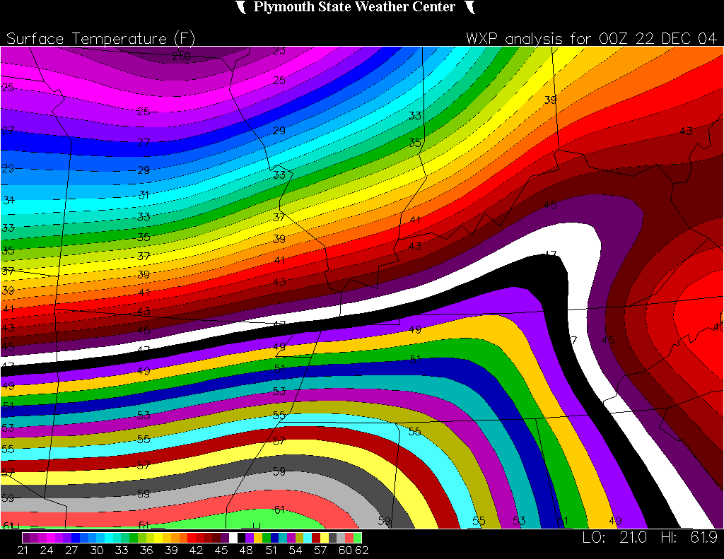
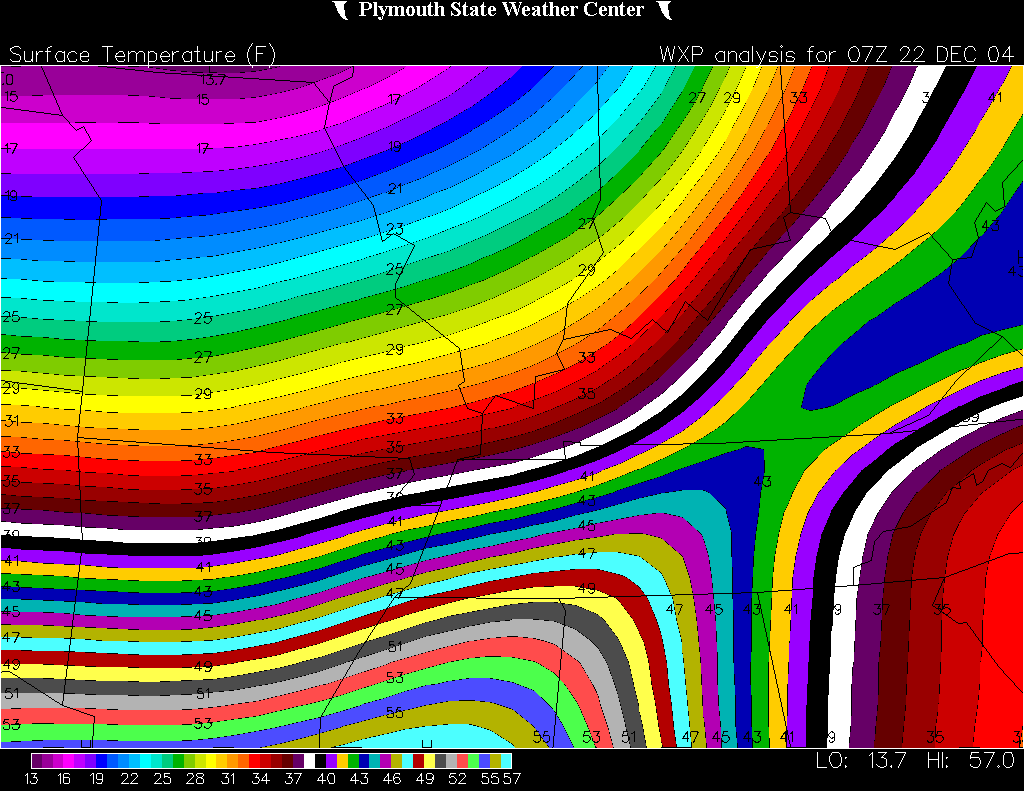
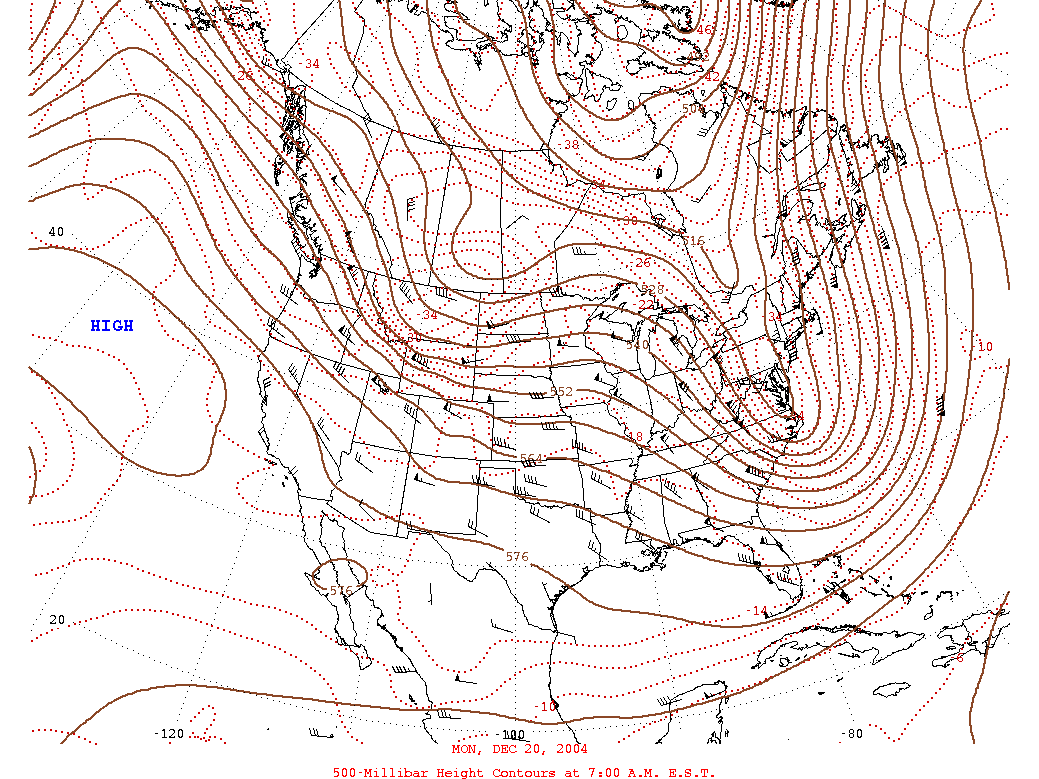
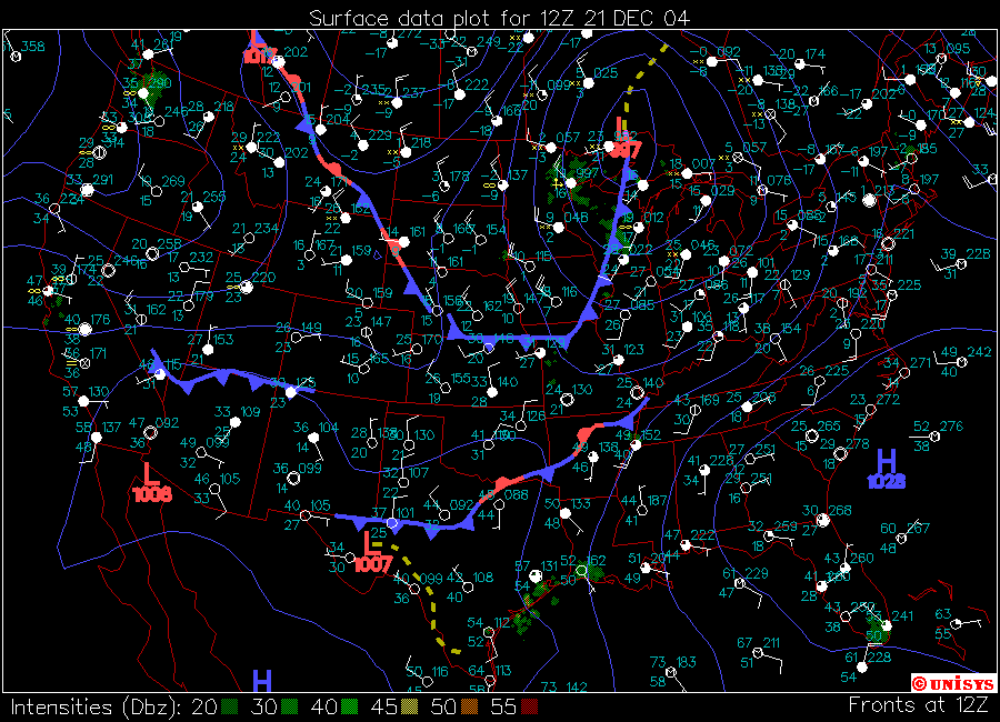
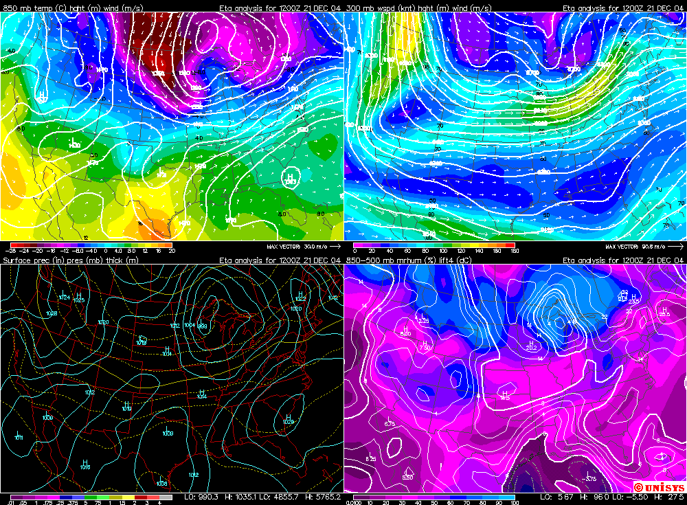
Tuesday, December 21st. Day 1 of the event.On Tuesday area residents waited for what forecasters were calling a potentially historic winter storm event for the City of Paducah. National Weather Service forecasters and area media warned residents that a significant ice and snow event would be possible during the next 24-36 hours. Nobody fully expected the extreme snowfall amounts that would eventually blanket the region. During most of Tuesday one would have been hard pressed to even believe the forecasters. Paducah was located on the warm side of a frontal system. Temperatures across the entire region were in the 50s. The high in Paducah was 52 degrees around three in the afternoon. Snow was the furthest thing from most peoples mind as everyone was trying to finish their Christmas shopping, preparing their houses for the arrival of friends and family, or readying their cars for the long drive to relatives to celebrate the holidays. Unfortunately, many of them would see their plans disrupted. By late afternoon it was becoming more obvious that a change in the weather was already underway. Clear skies clouded over after the lunch hour. Clouds would continue to lower and thicken through the afternoon. A cold rain began to fall during the early evening hours. By 8 p.m. moderate to heavy rain was falling here in Lone Oak. One last trip to Wal-Mart, at 10:30 p.m., provided myself an opportunity to watch (feel) the frontal passage. Within a 30 minute period the temperatures fell abruptly and winds became strong and gusty from the North/Northeast. Cape Girardeau was already reporting frozen precipitation at 11 p.m. Paducah would remain in rain for a few more hours. Precipitation, for the day (all liquid), would total around three quarters of an inch. |
|||||||||||||||||||
|
|||||||||||||||||||
|
|||||||||||||||||||
|
|||||||||||||||||||
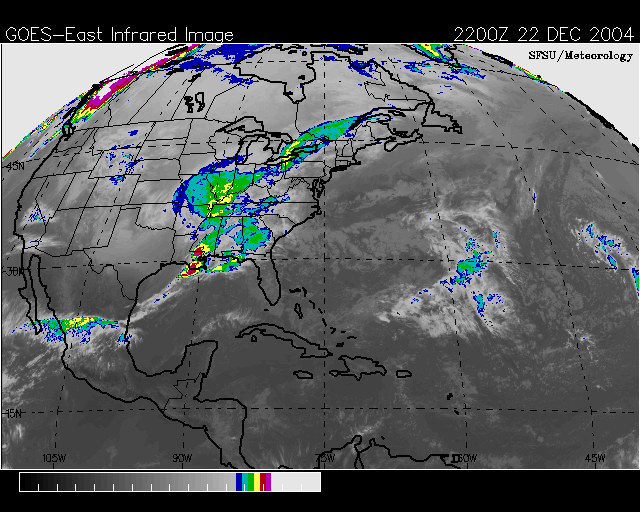
Wednesday, December 22nd. Day 2 of the event.
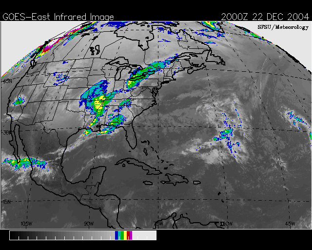
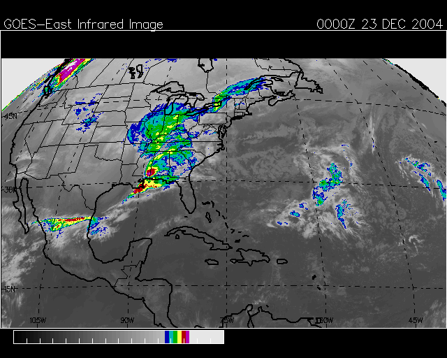
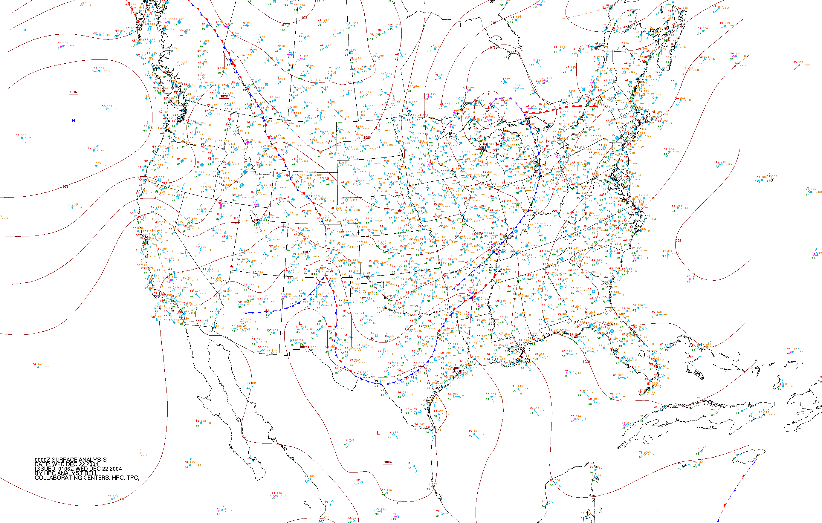
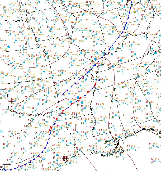
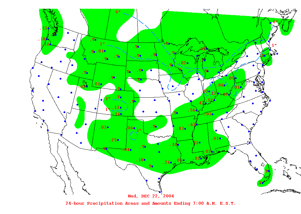
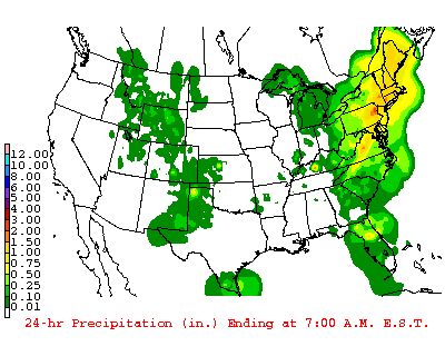
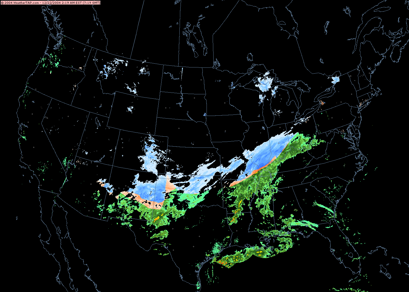
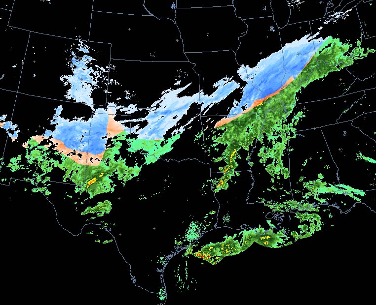
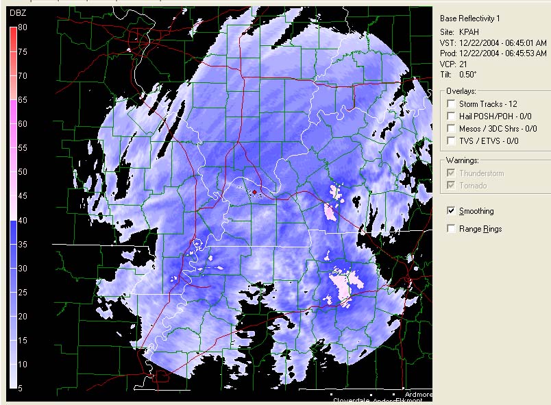
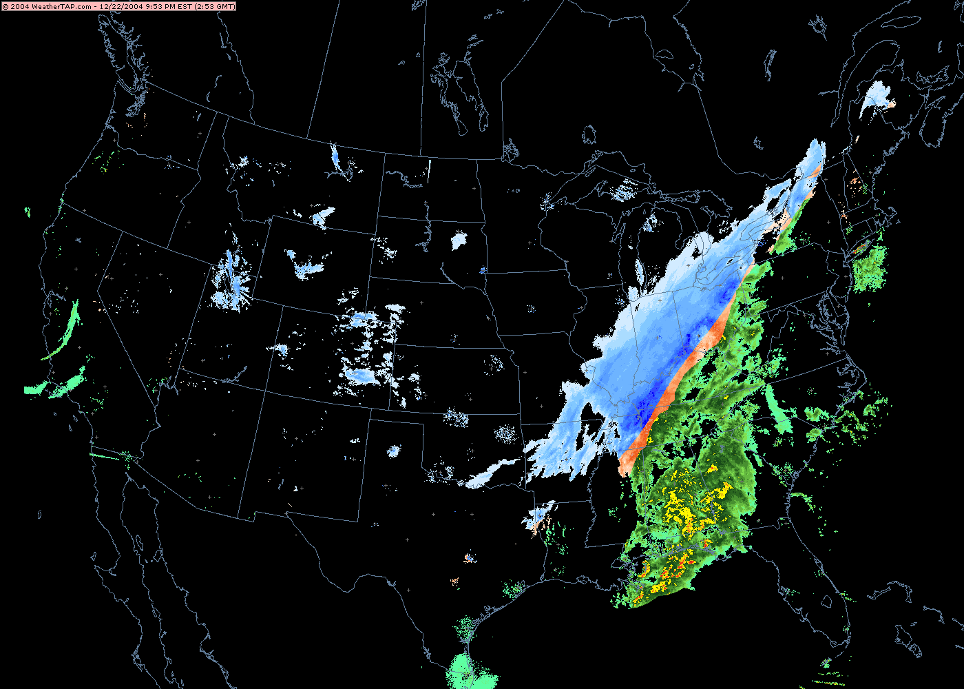
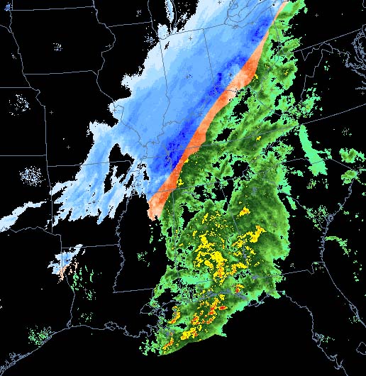
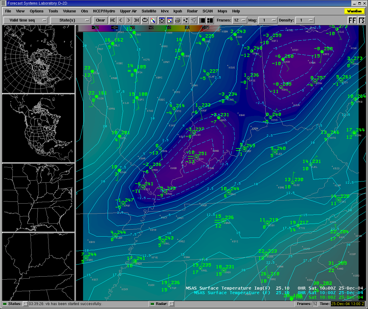
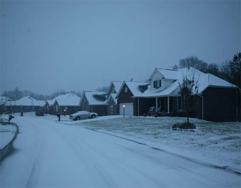
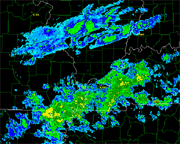
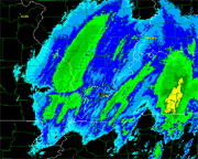
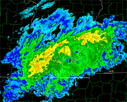
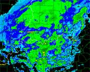
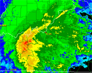
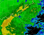
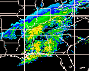
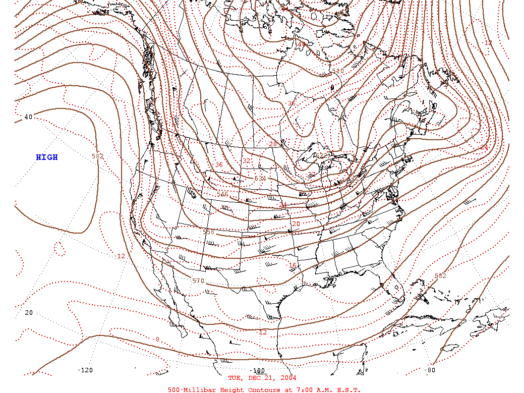
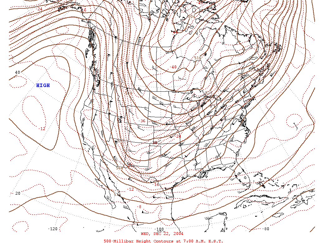
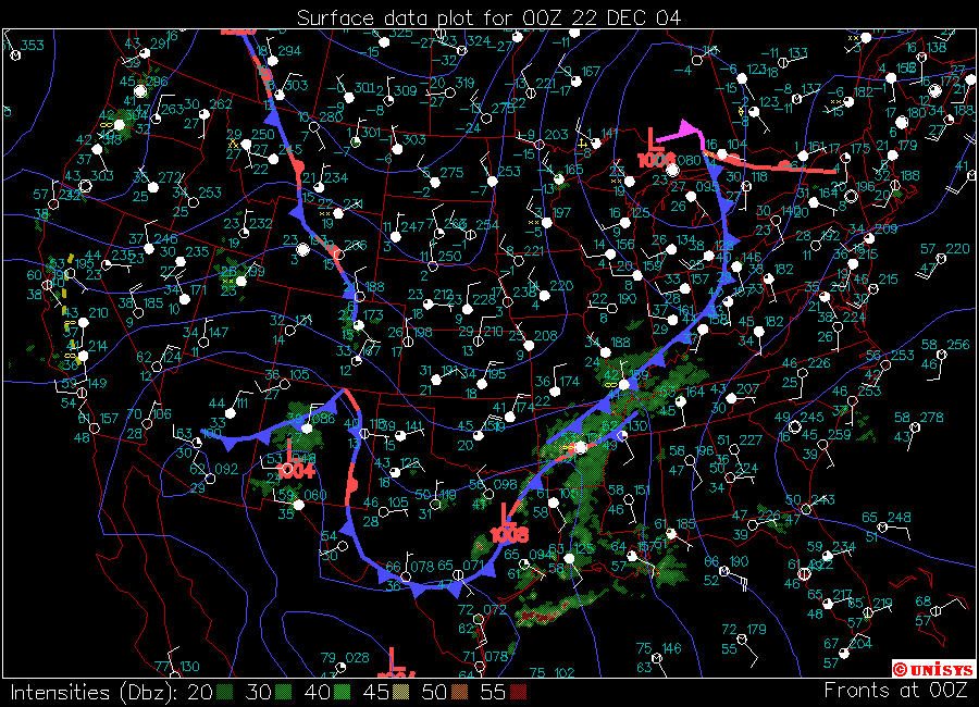
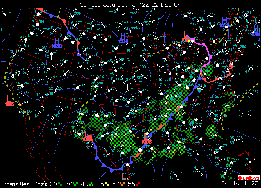
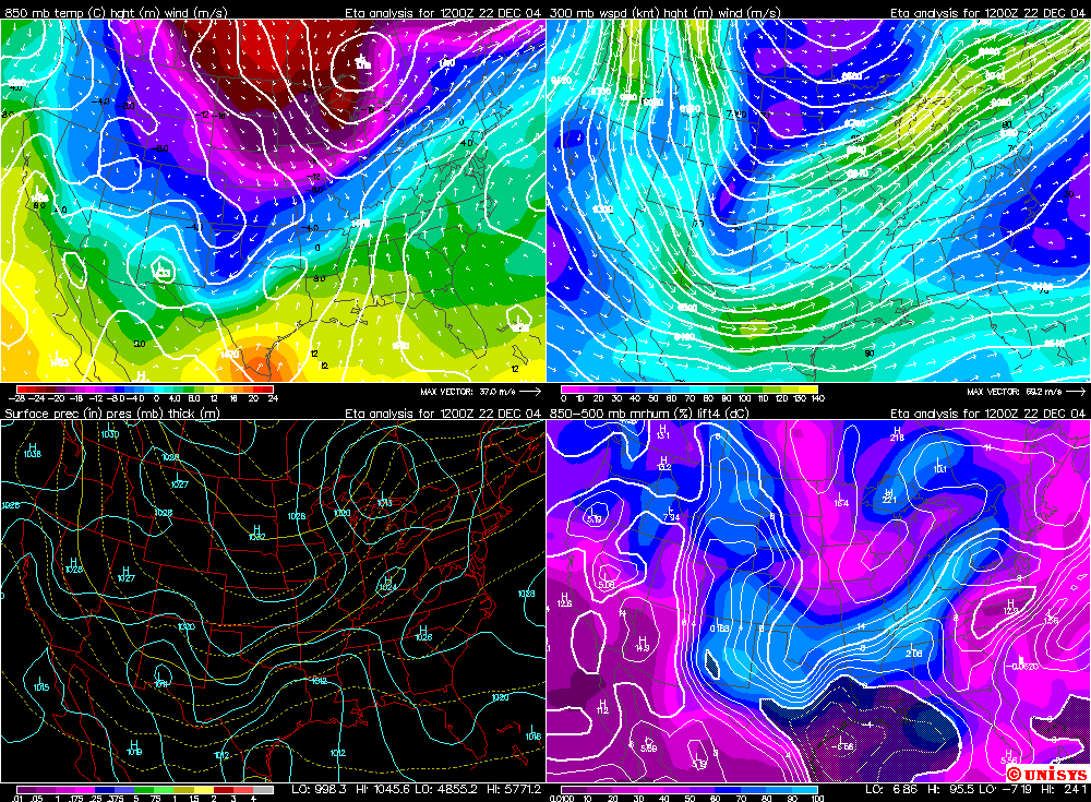
During the overnight hours of the 21st and into the morning of the 22nd Paducah, Kentucky residents would see significant changes in their weather conditions. Rain would turn to freezing rain and sleet by 2 a.m. This would then change to snow by 3 a.m. The snow would continue to fall until 10 a.m. that morning. Moderate snow fell between 6 and 8 a.m. Heavy snow was reported at Barkley Region Airport, in Paducah, at 8 a.m. The first round of precipitation brought four to five inches of snow to McCracken County. Areas around Paducah received between one and thirteen inches (more to the north and west than to the east and south). This snow caused havoc with area traffic. Numerous accidents were reported across the four state region. This would be the first round of heavy snow that would move through Paducah (as you can see on the long duration radar animation). When I first awoke, around 6 a.m., I was a bit disappointed by the amount of snow that had fallen. We had received barely a dusting of sleet and snow. It would take a few more hours to see significant accumulations across the county. By the time I headed out, around 9 a.m., three to four inches of snow had fallen across Paducah. Snow plows were out in full force. Roads were snow and ice packed. By noon the snow had ended but skies remained mostly cloudy. By late afternoon clouds would again rapidly lower as more precipitation moved in from the south and west. Radar indicated an explosion of precipitation across the Mississippi Valley in response to a developing area of low pressure moving out of the Gulf of Mexico. This low would track through Louisiana and into Central and Eastern Tennessee. This is a classic track for winter weather across this area (West KY, Southern IL, and Southeast MO). The storm would certainly not disappoint the winter weather enthusiasts. Conditions would rapidly deteriorate to near blizzard conditions during the late evening hours. Roads would become virtually impassable to normal vehicles as drifting became severe across most of the county and city roads. Snowfall rates of 1-3 inches per hour were reported across Southern Illinois and Western Kentucky. Although temperature profiles, in Paducah, were borderline for ice almost all of the precipitation remained in the form of snow. Areas to the east were not so fortunate, as heavy ice accumulations were reported near the Kentucky Lake area and eastward. Portions of Central Kentucky reported over one and a half inches of ice. In many areas this caused a disruption in power. Conditions in Paducah approached blizzard conditions during the evening hours of the 22nd. Wind gusted over 40 miles per hour, on a number of occasions, here in Lone Oak. The National Weather Service reported gusts over 30 miles per hour at the airport. This led to severe blowing and drifting snow. Snow drifts in excess of four feet were noted here in Lone Oak by the midnight hour. Driving conditions continued to worsen through the evening. Hundreds of vehicles were abandoned on Interstate 24 across several Western Kentucky Counties because of blowing and drifting snow. The National Guard was called out to help rescue people from their vehicles. |
|||||||||||||||||||
|
|||||||||||||||||||
|
|||||||||||||||||||
|
|||||||||||||||||||
|
|||||||||||||||||||
|
|||||||||||||||||||
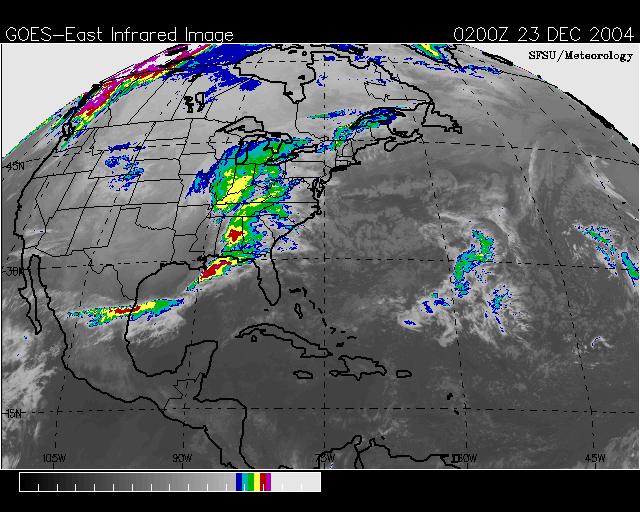
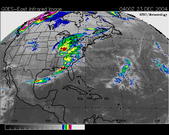
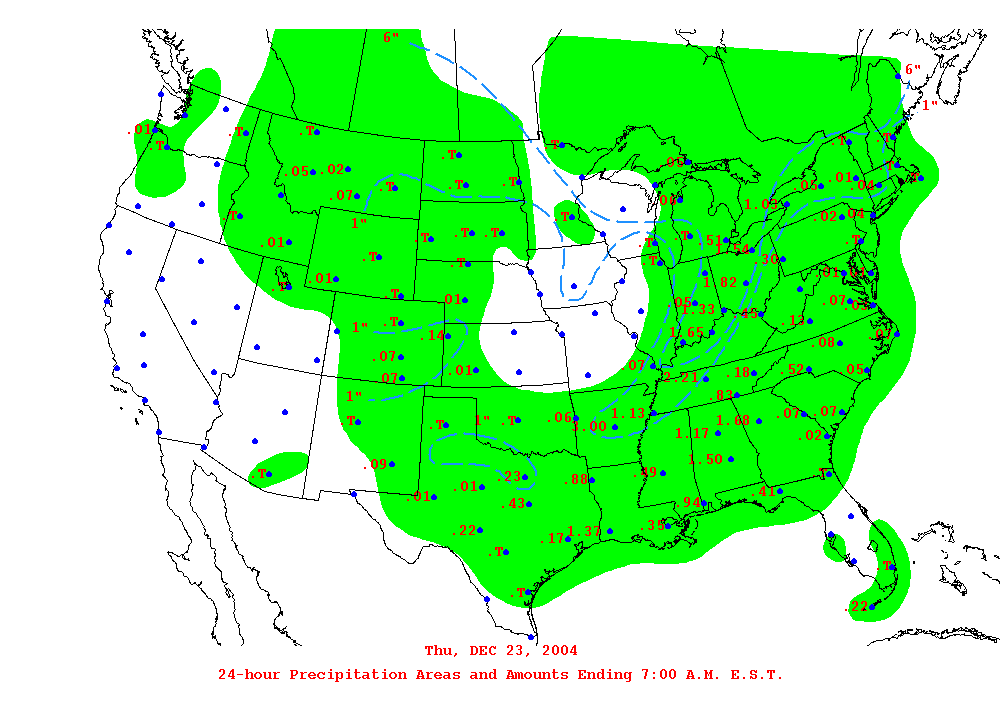
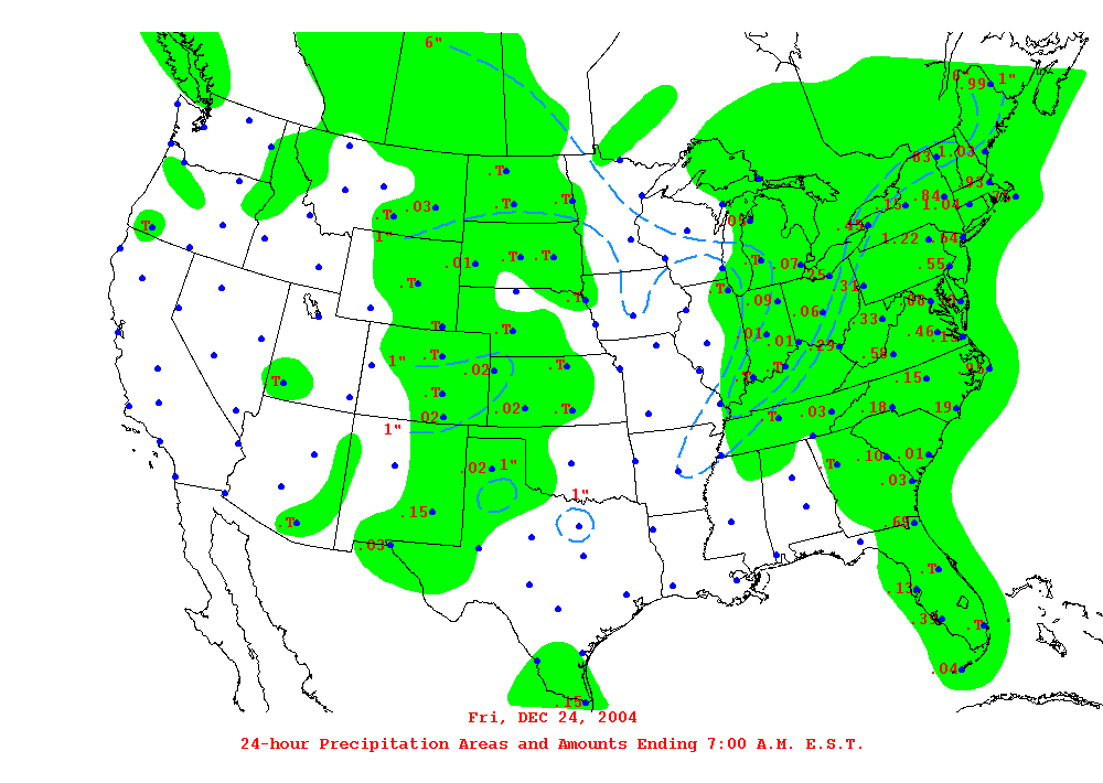
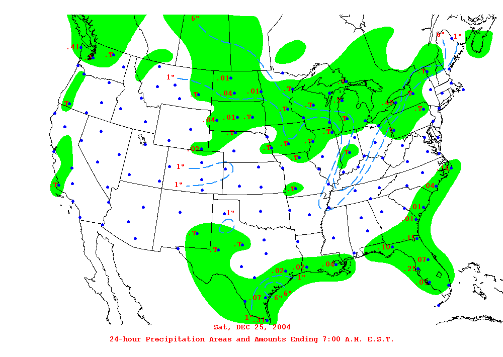
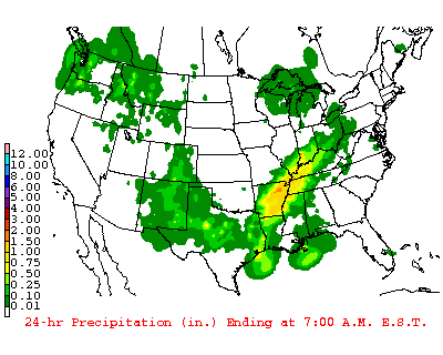
Thursday, December 23rd. Day 3 of the event.
|
|||||||||||||||||||
|
|
|
|
||||||||||||||||
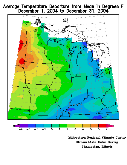
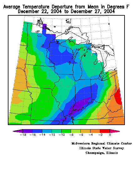
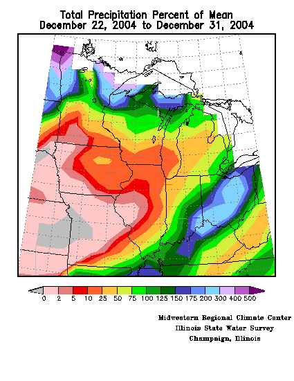 Total Precip Departure for Dec 22-31. Extremely high readings across this region. |
|
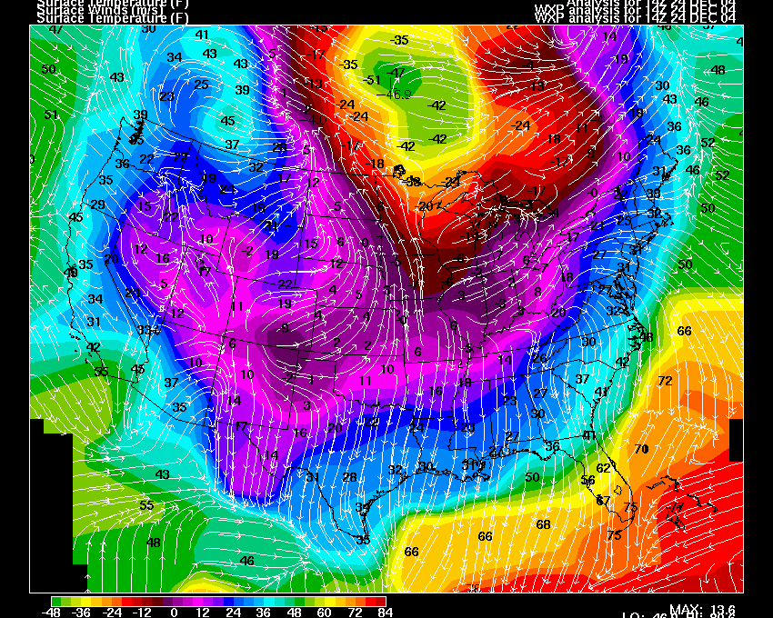
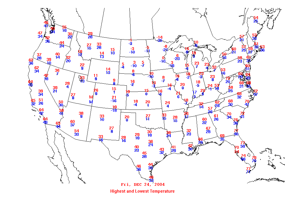
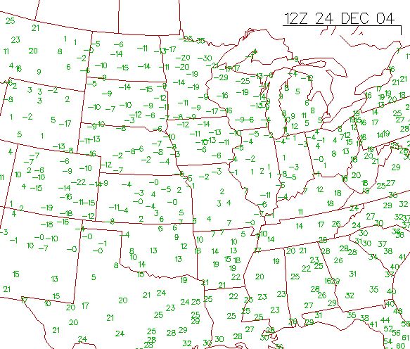 December 24th morning low temperatures were below zero across large areas of the U.S. |
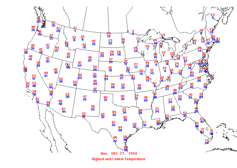
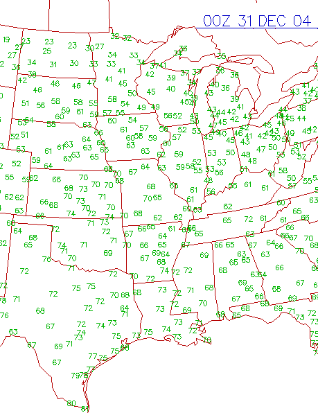 By December 30th temperatures had rapidly rebounded across the same areas. |
||||||||||||||||
| | KPAH METAR Dec 21 | KPAH METAR Dec 22 | KPAH METAR Dec 23 | | |||||||||||||||||||
| Paducah Meteogram 21st-23rd | |||||||||||||||||||
| 12/20 - 12/25 Paducah, Kentucky, NWS Area Forecast Discussions | |||||||||||||||||||
| 12/20 - 12/25 Louisville, Kentucky, NWS Area Forecast Discussions | |||||||||||||||||||
| 12/20 - 12/25 Indianapolis, Indiana, NWS Area Forecast Discussions | |||||||||||||||||||
| 12/20 - 12/25 Wilmington, Ohio, NWS Area Forecast Discussions | |||||||||||||||||||
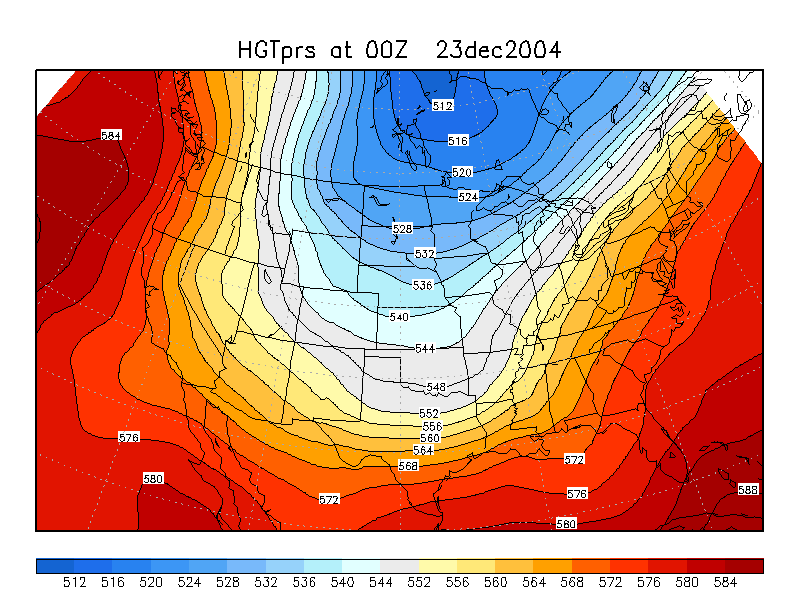
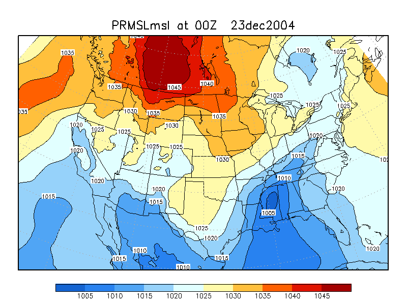
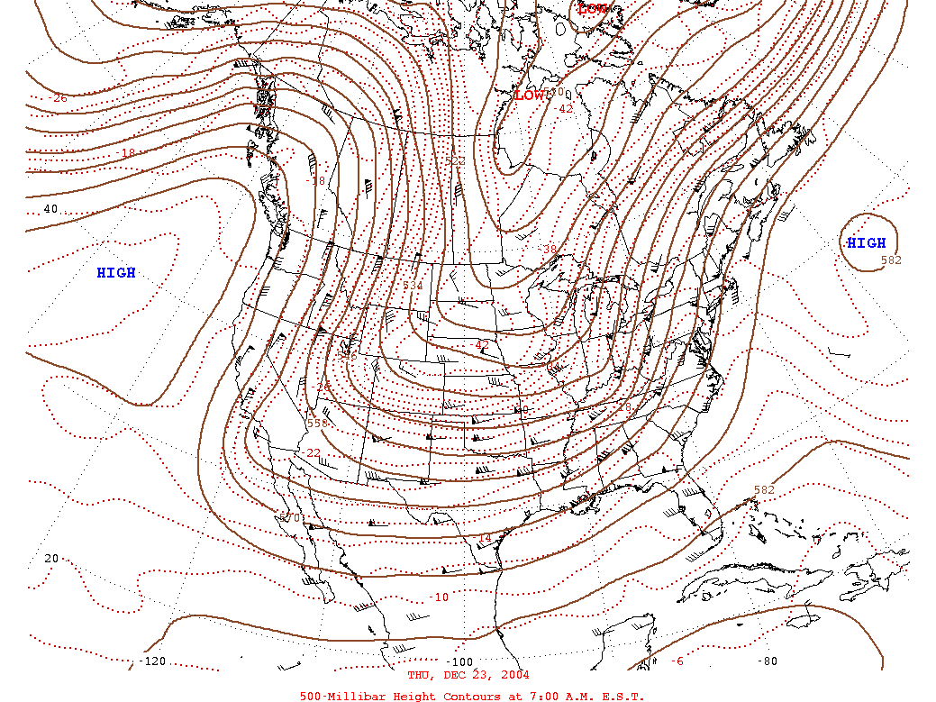
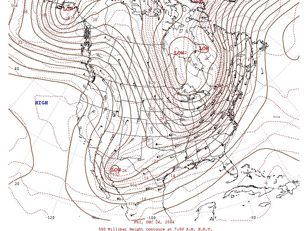
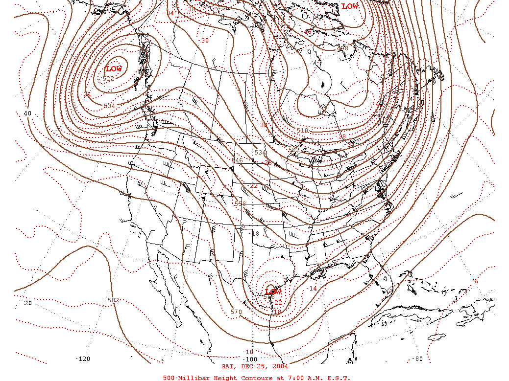
| 500 mb Maps. December 20th through December 25th | |||||||||||||||||||
|
|
|
|
||||||||||||||||
|
|
||||||||||||||||||
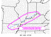
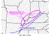
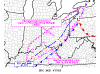
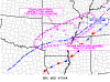
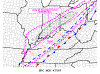
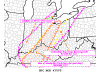
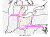
| Storm Prediction Center Mesoscale Discussions | |||||||||||||||||||
| December 21st through December 23rd | |||||||||||||||||||
|
|
|
|
||||||||||||||||
|
|
|
|
||||||||||||||||
|
|
|
|
||||||||||||||||
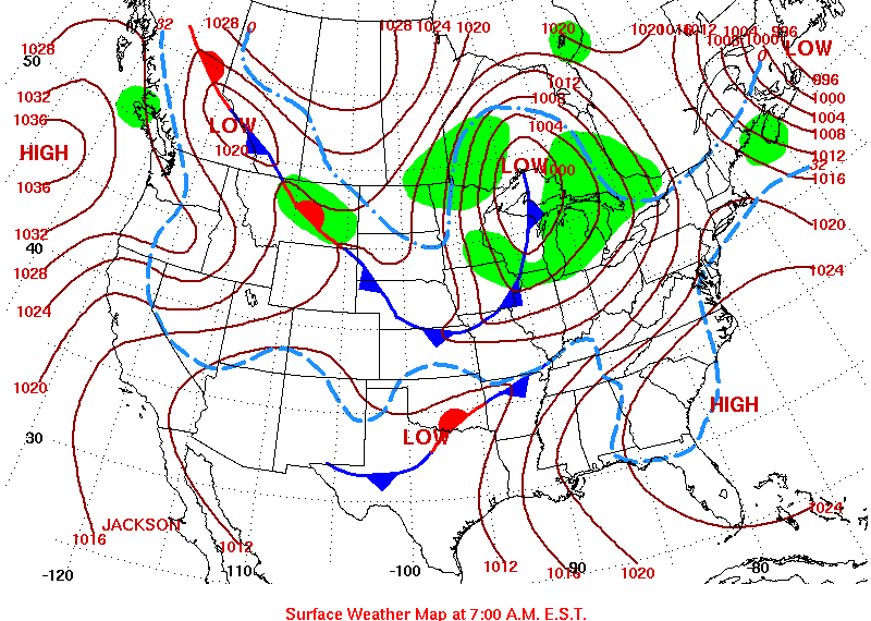
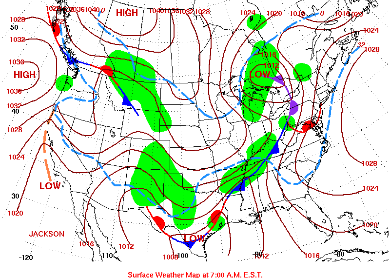
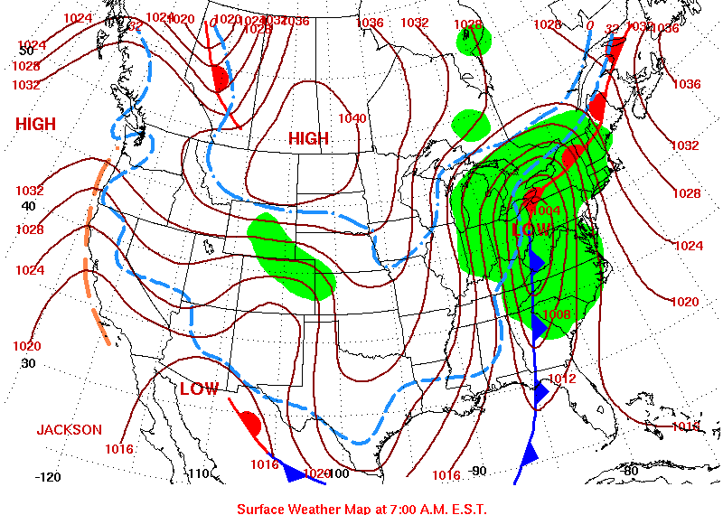
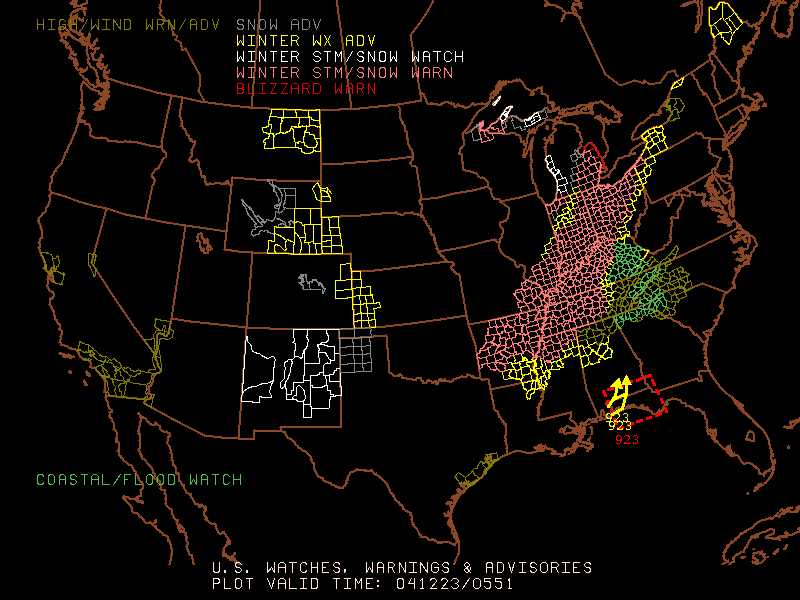
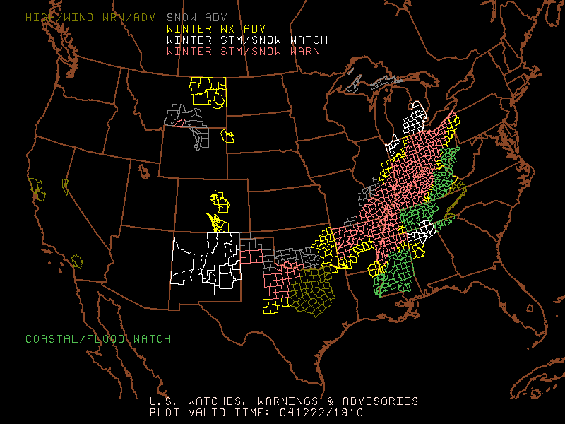
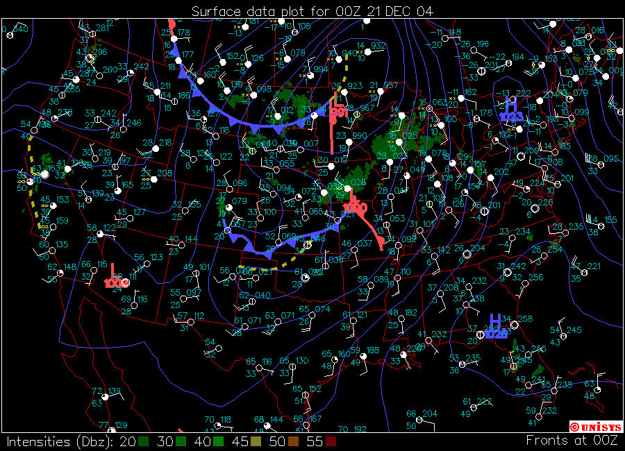
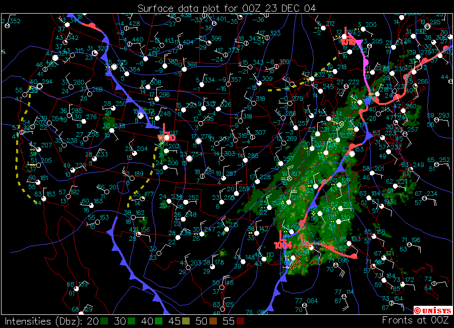 12/23/04 00z Surface Map |
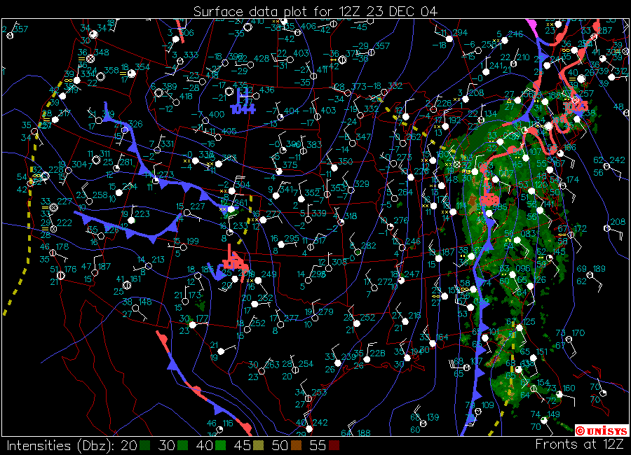 12/23/04 12z Surface Map |
 12/24/04 00z Surface Map |
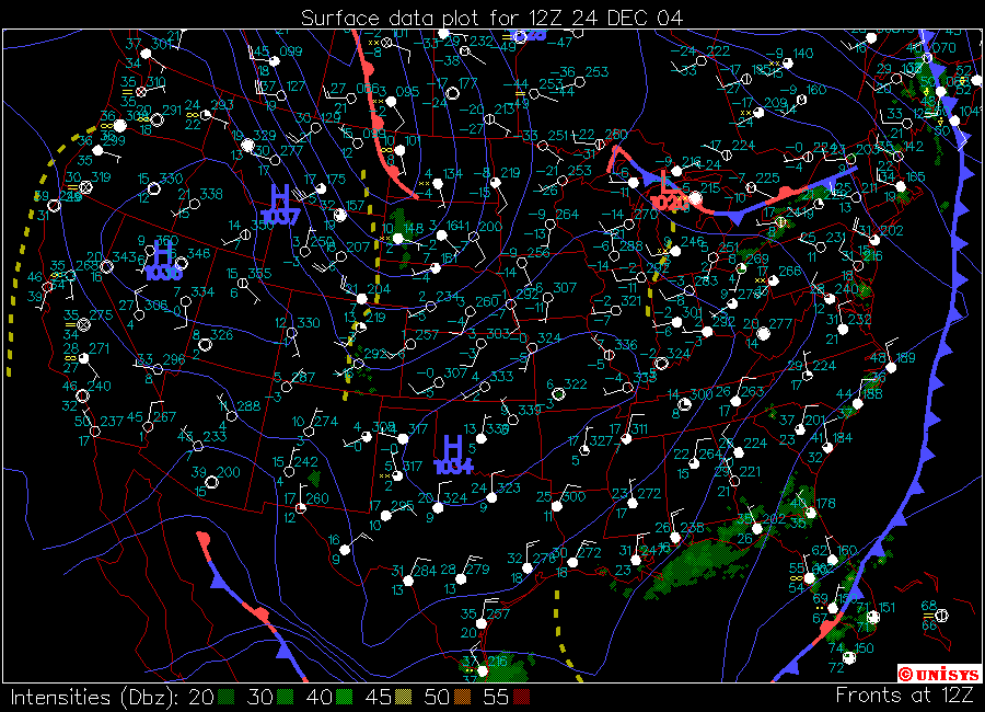 12/24/04 12z Surface Map |
||||||||||||||||
|
|
|
|
||||||||||||||||
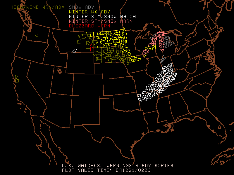
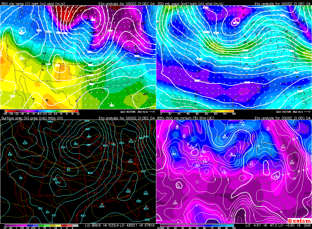
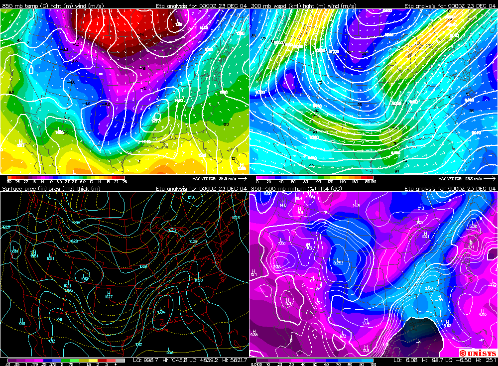 12/23/04 00z 4 Panel Midwest Winter Maps |
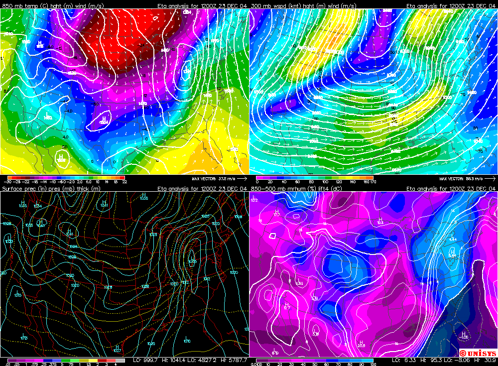 12/23/04 00z 4 Panel Midwest Winter Maps |
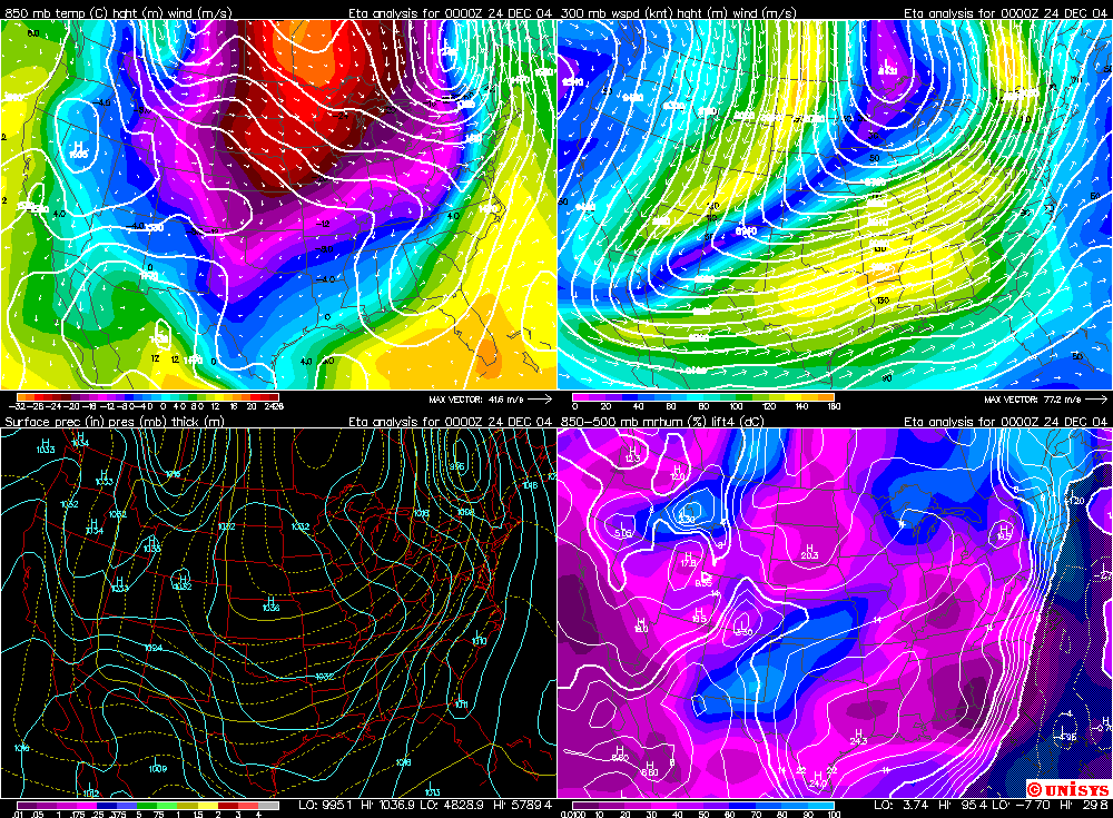 12/24/04 00z 4 Panel Midwest Winter Maps |
|||||||||||||||||
| Bitterly Cold Air Swept in Behind the Storm System | |||||||||||||||||||
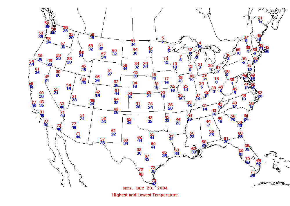
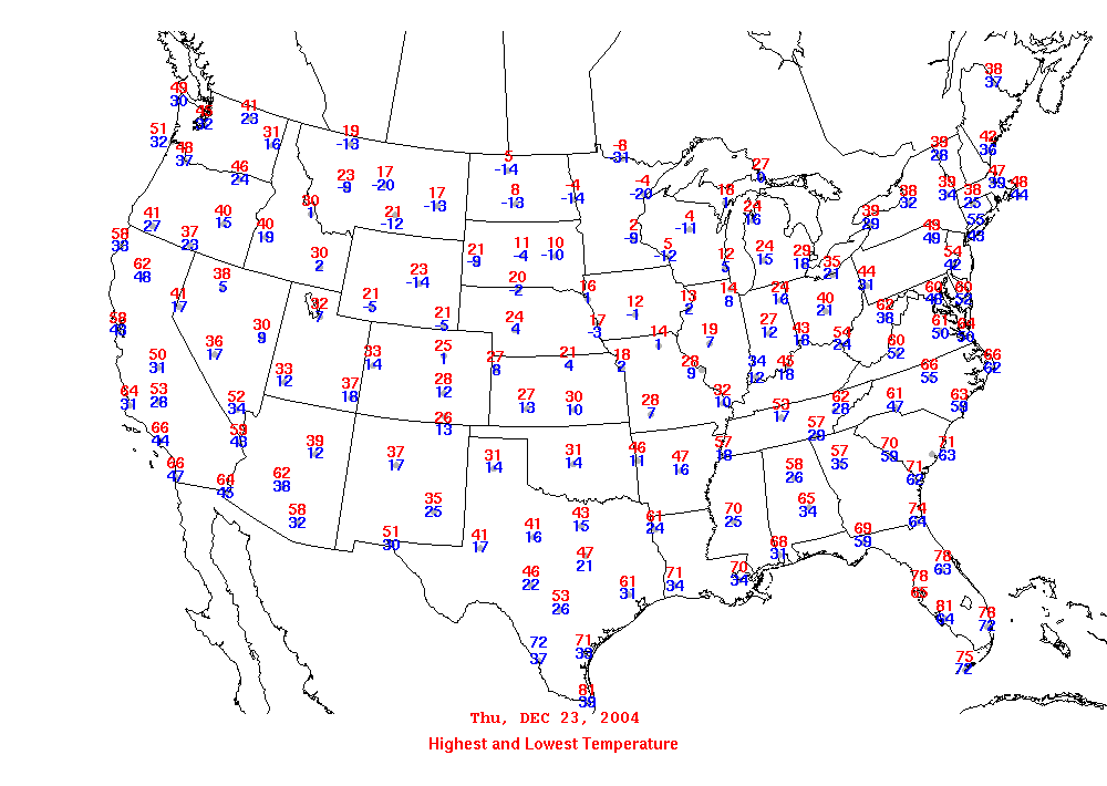
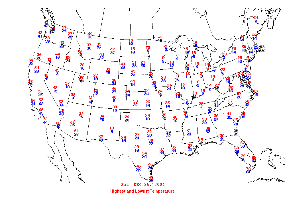
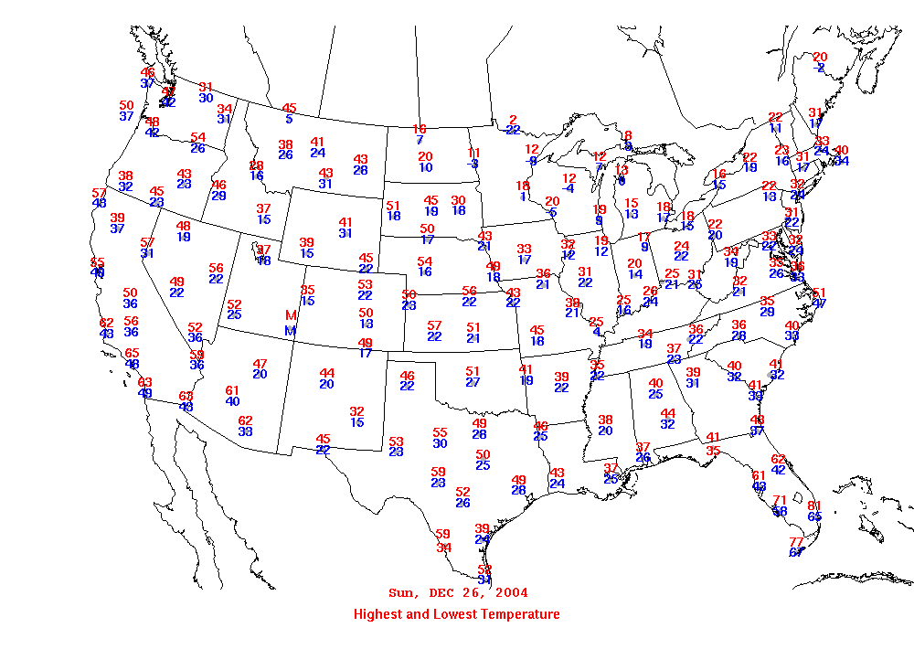
| Daily High and Low Temperature Maps 12/20-12/27 | |||||||||||||||||||
|
|
|
|
||||||||||||||||
|
|
|
|
||||||||||||||||
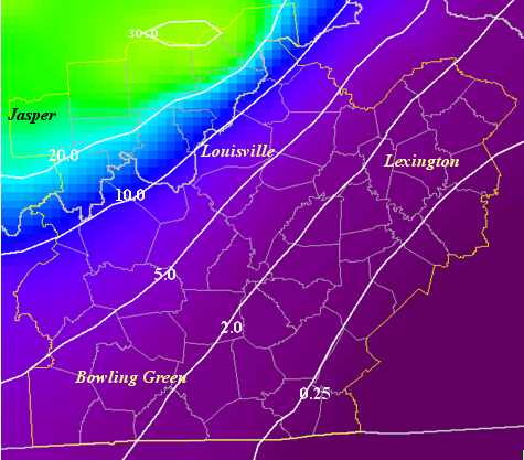
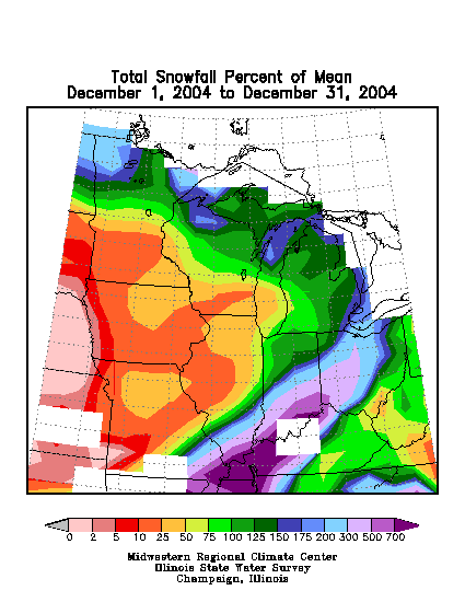
| Location of Heavy Snow/Ice Areas -- NWS Maps | |||||||||||||||||||
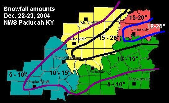
Snowfall and Ice Totals |
Snowfall and Ice Totals |
||||||||||||||||||
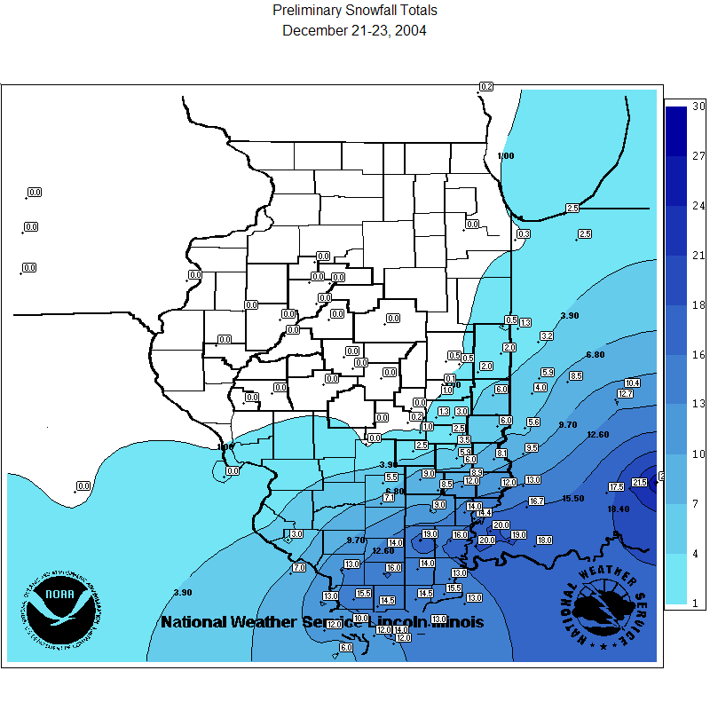
Missouri, Illinois, Indiana, and |
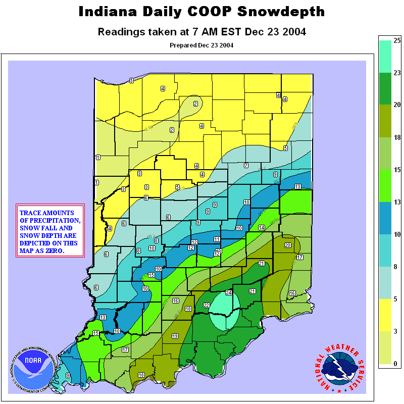
IndianaSnowfall and Ice Totals |
||||||||||||||||||

Indiana, Ohio, and Kentucky |

Southeast Michigan Snowfall Totals |
||||||||||||||||||
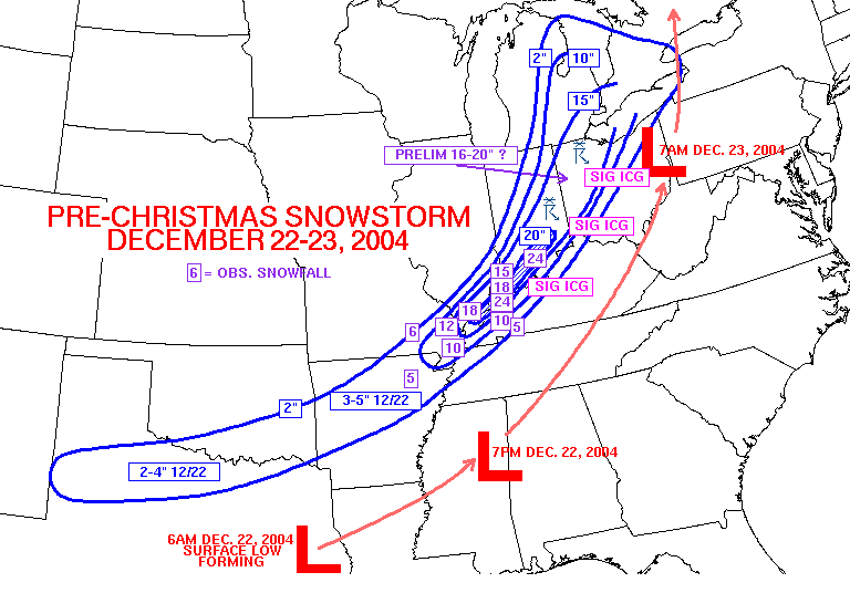 Pre-Christmas Storm Snowfall Totals Image provided by the Storm Prediction Center |
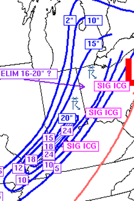 Pre-Christmas Storm Snowfall Totals/Thundersnow Image provided by the Storm Prediction Center |
||||||||||||||||||
| ARCHIVED SNOWFALL TOTALS - CASE STUDY FROM MRCC | |||||||||||||||||||
| Paducah, NWS Snowfall Totals (Text) | |||||||||||||||||||
| Louisville, NWS Snowfall Totals (Text) | |||||||||||||||||||
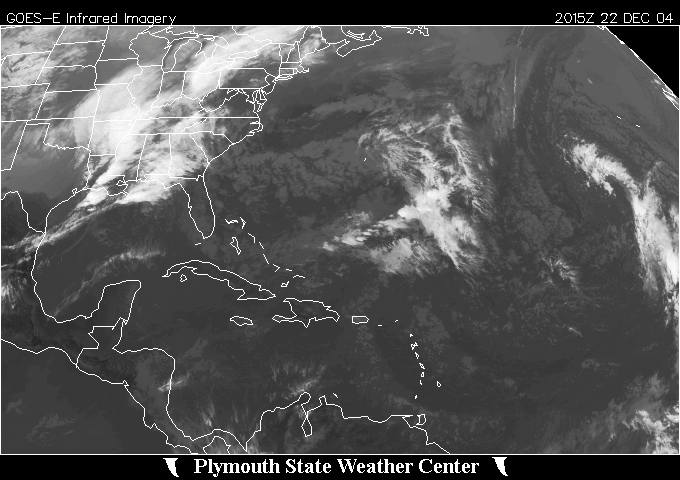
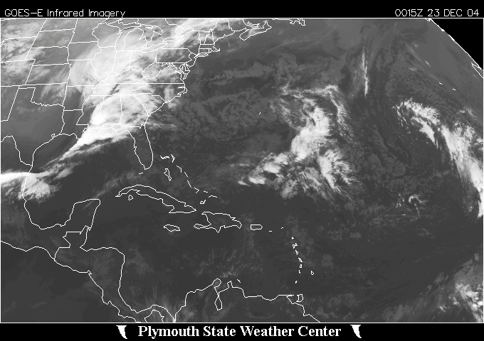
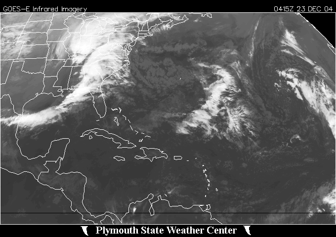
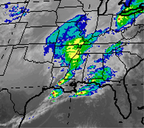
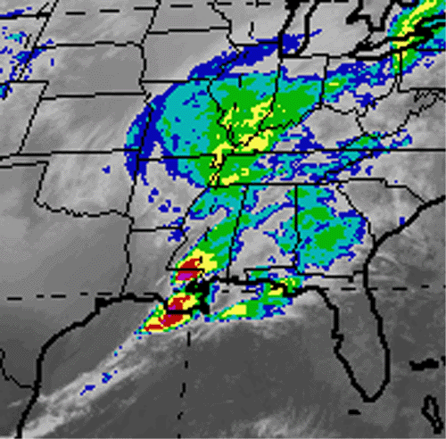
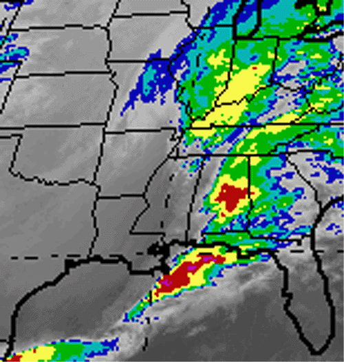
Ohio Valley Enhanced
|
Color Enhanced
|
||||||||||||||||||
Large Northern Hemisphere
|
Enhanced Water Vapor Image
|
||||||||||||||||||
Central U.S. Zoomed
|
Illinois Water Vapor
|
||||||||||||||||||
Ohio Valley Water Vapor
|
Eastern U.S. Enhanced
|
||||||||||||||||||
Michigan Water Vapor
|
Northeast U.S. Thunderstorms
|
||||||||||||||||||
Michigan Water Vapor
|
Northeast U.S. Thunderstorms
|
||||||||||||||||||
Michigan Water Vapor
|

Northeast U.S. Thunderstorms
|
||||||||||||||||||

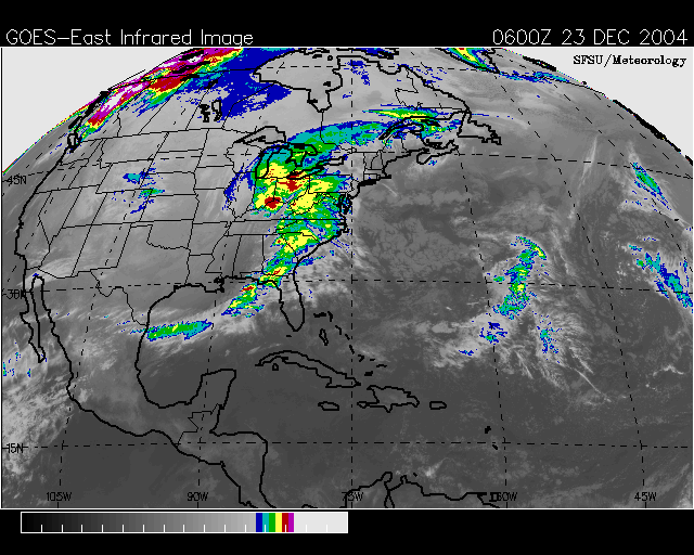
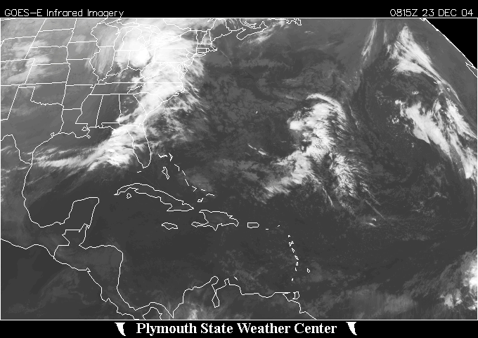
December 23rd Winter Storm
|
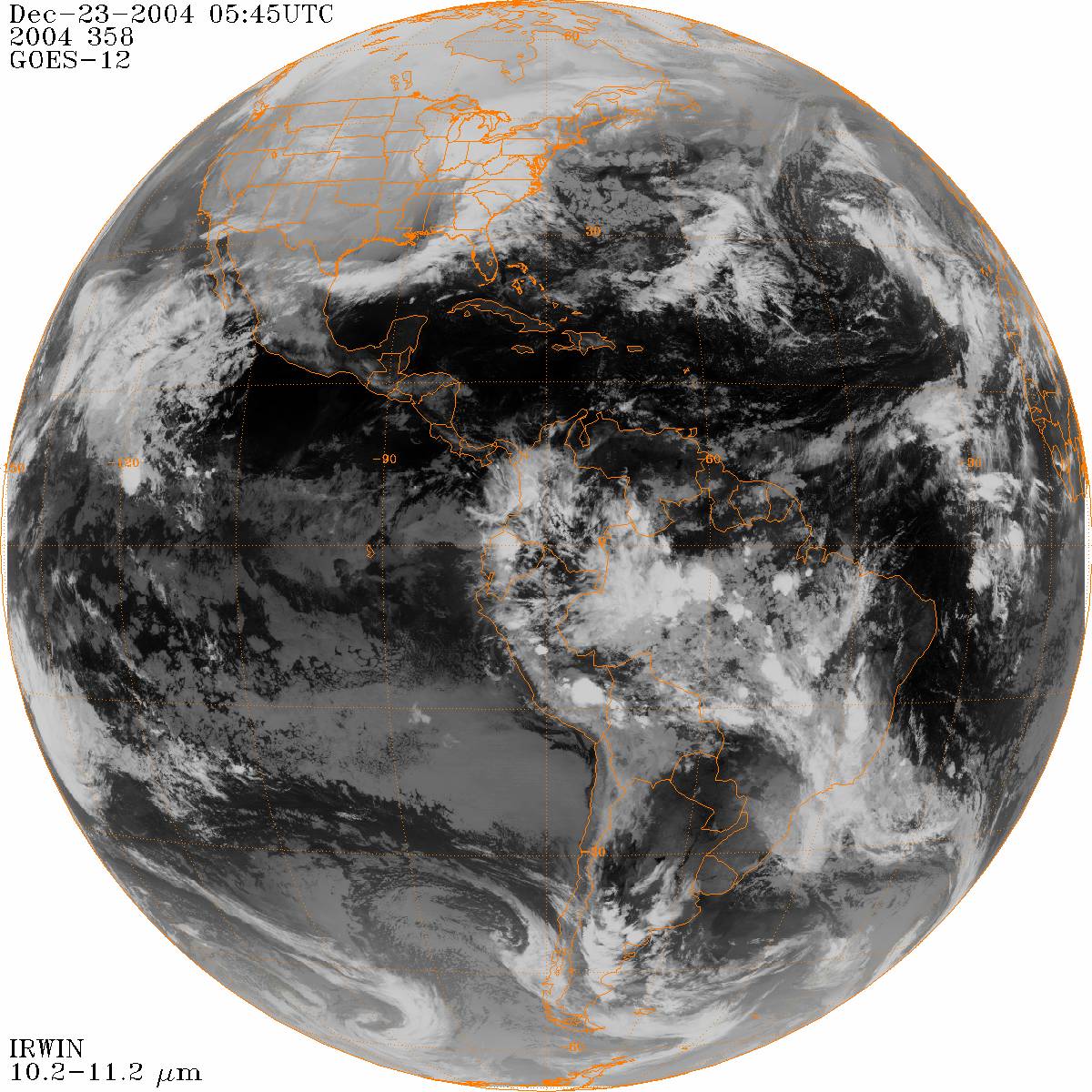
December 23rd Winter Storm World View
|
||||||||||||||||||
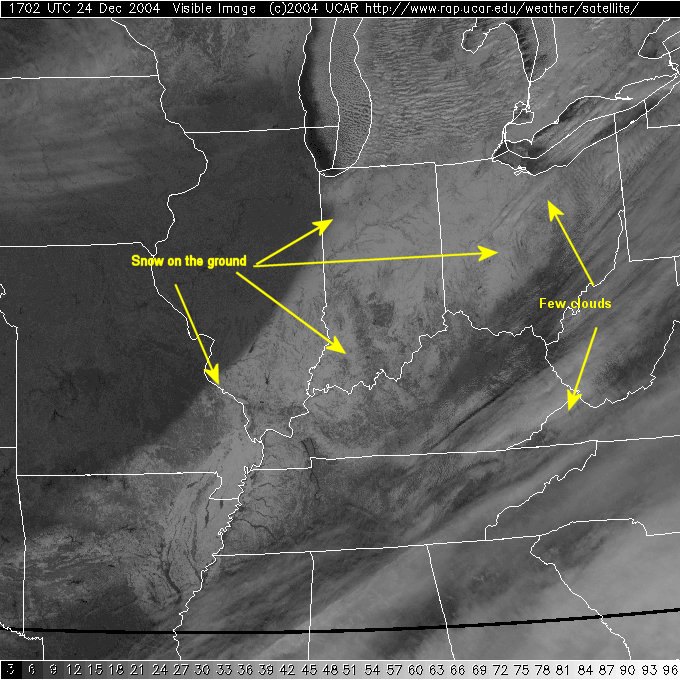
Visible Image showing the Snow Cover
|
|||||||||||||||||||
| Top of Page | |||||||||||||||||||
|
General Storm Evolution | Daily Highlights | Snowfall Total Maps | Satellite Imagery |
|||||||||||||||||||
|
Page design inspired by cimss.ssec.wisc.edu |
|||||||||||||||||||
|
Please notify me of any errors on this page. |
|||||||||||||||||||


